
 العربية
Use of Cookies by this site is just to guarantee Ease of Access and better user experience while browsing. Continuation of your browsing acknowledges your approval for Terms and Conditions of this site and its use of Cookies.
Privacy PolicyWebsite belongs to an official government organization in the Kingdom of Saudi Arabia always ends with .gov.sa
Secured governments websites in the Kingdom of Saudi Arabia use Https encryption.

Aqabat Al-Jawh, also known as the Al-Jawh Pass, traverses diverse landscapes, offering travelers a scenic and essential route between Sarat Ubaid Governorate and Al-Farsha Center. The pass winds through rugged mountains, verdant valleys, and arid plains, providing panoramic views of the surrounding natural beauty. Lush vegetation adorns the slopes, creating a serene oasis amidst the rocky terrain. Along the route, travelers may encounter traditional villages, ancient ruins, and cultural landmarks, offering glimpses into the rich heritage of the region.

Throughout history, Aqabat Al-Jawh has played a significant role in facilitating travel and trade between Sarat Ubaid Governorate and Al-Farsha Center. Its strategic location and challenging terrain have made it an important link between these two areas, fostering economic development and cultural exchange. Over the years, the pass has witnessed the passage of traders, pilgrims, and travelers, contributing to the vibrant tapestry of cultures and traditions in the region. Today, Aqabat Al-Jawh continues to be a cherished pathway, connecting communities and fostering connectivity and prosperity between Sarat Ubaid Governorate and Al-Farsha Center.
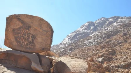
The mountain is part of the Asir Mountains range, which is characterized by its steep slopes and rocky cliffs. It is primarily composed of granite and other igneous rocks, formed through geological processes over millions of years.

Despite its arid surroundings, the mountain supports a variety of plant and animal life. It serves as a habitat for several endemic species adapted to the harsh mountain environment.
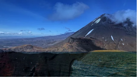
The mountain holds cultural significance for the local communities, who often regard it as a symbol of their heritage and identity. It features in local folklore and traditions, and its slopes may contain archaeological sites or remnants of ancient civilizations.
Explore the future of weather forecasting with the Anwaa app, featuring real-time alerts, advanced climate analytics, and personalized forecasts for unparalleled accuracy and preparedness.


Use of Cookies by this site is just to guarantee Ease of Access and better user experience while browsing. Continuation of your browsing acknowledges your approval for Terms and Conditions of this site and its use of Cookies.
Privacy Policy.png)
When you visit any website, it may store or retrieve information on your browser, mostly in the form of cookies. This information might be about you, your preferences or your device and is mostly used to make the site work as you expect it to. The information does not usually directly identify you, but it can give you a more personalized web experience. Because we respect your right to privacy, you can choose not to allow some types of cookies. Click on the different category headings to find out more and change our default settings. However, blocking some types of cookies may impact your experience of the site and the services we are able to offer.